A border with challenges
Deciding on the path of the border between Germany and Denmark in 1920 wasn’t always easy as Sønderjylland became Danish once more.
In 2020 it was 100 years since the northern part of Schleswig (Sønderjylland) returned to Denmark. What few people realise today, however, is that a number of dramas occurred when the exact path of the border was chosen all those years ago.
Just for a moment, we’ll turn back the clock. In the war of 1864, Denmark suffered a crushing defeat at the hands of Prussia, which annexed the region between Kongeå and the Eider into the Prussian empire – in practice the former Duchy of Schleswig.
This state of affairs lasted until 1918, when Germany was defeated in the First World War. During subsequent peace negotiations, the Danish government put forward a claim – the so-called Aabenraa resolution – that referendums should be held in the northernmost regions of Germany to determine the future affiliation of these regions.
This was adopted when Germany signed the Versailles Treaty in 1919. On 10th February 1920, a referendum was held in the northern zone, which stretched from the border at Kongeå to the current border.
75% of the votes cast here wanted a return to Denmark. A month later a referendum was held in the southern zone, which included Flensburg and the islands of Sylt and Föhr. In this case, the outcome was turned on its head, with 80% voting to remain German.
Now it was time to decide on the exact path of the border – and this caused several headaches.
In autumn 1920, an international commission with delegates from Britain, France, Japan, Italy, Denmark and Germany headed into the border country to determine the exact path of the border. A description of which streams and watercourses the border should follow already existed, but things proved to be rather more difficult in practice.
For instance, several of the region’s many farmers would end up with fields in both Denmark and Germany if the original plan was followed. It was therefore deviated from in several places so that farmers could consolidate their fields in a single country, although this wasn’t possible everywhere.
At Padborg, the Danish national railway company was in the process of building a border station. The commission also took this into account and Denmark received a small area of land that should have been German.
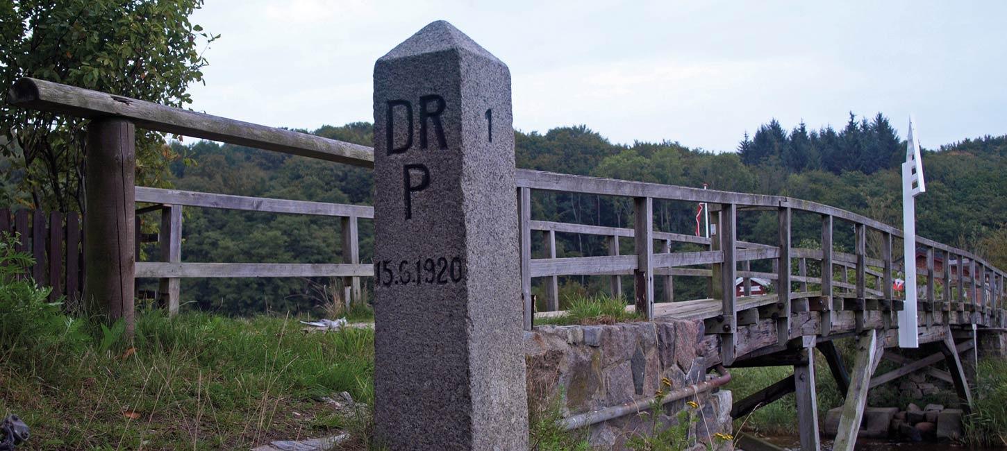
Once the commission had made its decision, the definitive border was marked by several hundred border stones bearing a capital “D” for Denmark, whilst “DRP” stands for Deutsches Reich Preussen. Between the two names is a line which marks the exact position of the border.

Photo:Ulrik Pedersen
Odd border in Rudbøl
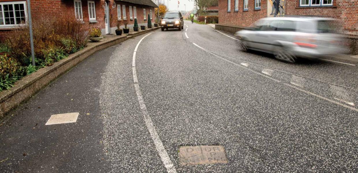
When the border commission reached the small, but elongated village of Rudbøl, a strange thing occurred. The stream of Vidå runs through the village and the plan was to let this define the path of the border, which geographically would be most logical. However, this would mean that a couple of smallholders of Danish disposition would remain on the German side, which they were very much against. A referendum amongst the affected citizens was thus arranged, which fortunately had a happy outcome.
The inhabitants on the western part of the section of road all wished to be part of Denmark, whilst the inhabitants on the eastern part of the road preferred to remain German.
The inhabitants thus drew up a proposal for an alternative border route and – following a considerable amount of discussion – managed to convince the border commission. As a result, since 1920 the border has run slightly south of Vidå – in the middle of the road in a divided town in which the German part of the town is called Rosenkranz.
The houses on one side of the road are in Denmark, while the houses opposite a few metres away on the other side of the road are German. This also means that one of the houses has a door to Denmark and a door to Germany.